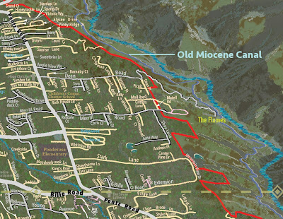
A map for the rebuild.
Streets are laid into the folds of hills and creekbeds, and land forms are drawn in relief with shadow, in Mapa Jeff's signature technique. The result is a a unique three-dimensional illustration of the landscape.
Other than ghost graphics for the churches temporarily lacking a facility, this map indicates as little as possible the tragedy of November 8, 2018. All street names from the time before are on this map, aside from a few whose new owners have already decided to take them private.
The first image shows the first edition print, covering Paradise proper, available in stores as of Jan. 27, 2021.
The last shows the large version, which shows the region all the way to Mount Shasta. It is 3 by 5 feet in size, and there is so far only one print. It hangs at the Paradise Building Something or other... the newer municipal building up a ways. I donated it to the town.
Both are available for sale exclusively at Chico Paper Company, 345 Broadway, Chico. The larger map must be custom-printed and can also be customized by the artist since they will be printed one at a time.


No comments:
Post a Comment