Nuevo Vallarta in rich, beautiful detail.
Mapa Jeff's ninth foldable map title showed Nuevo Vallarta's resorts, residential areas, beaches and natural features in deep, hand-drawn detail. Dated 2019 - so it's missing many new developments. But I was always proudest of the thoroughness of my map of the Mexican side of the highway: Valle Dorado. The town planned and built at the same time as the oceanward precincts were being carved up (quite beautifully) into Gringoparadiso.
Available as a portable, foldable map to take with you on the plane, or mailed as a small poster in a tube (order two and you can frame them both together).
STILL ABOUT 10 OF THESE LEFT.
I p
Mail order folded up here.
Mail order in a tube here.
Side A: Central Nuevo Vallarta.

Side B: The northwest coast, Flamingos, and a detailed map of Valle Dorado.

5" by 7" folded, with a locator map on the cover.

Marina Nuevo Vallarta and Paradise Village.

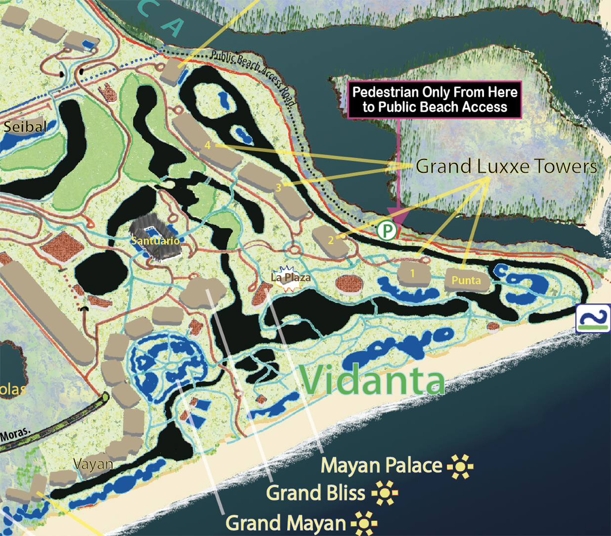
Inside Vidanta - plus how to reach the public beach
at the Rio Ameca.

Both public and private streets are thoroughly named and detailed.


Detail from regional inset map.

Or browse Mapa Jeff's online store for maps of the entire Puerto Vallarta/Riviera Nayarit/Cabo Corrientes region.
Mapa Jeff maps are the work of one author/artist with professional journalism and editorial experience. They are the product of a long-term residence, extensive exploration and research, and frequent, careful updating. They carry no advertising, have no paid placements, and have no agenda other than to provide the most thorough and legible portrait of the landscape.
What do you have close to Sayulits?
ReplyDeleteI have completed maps of La Cruz, Bucerias, Sayulita, and San Pancho, as well as a regional map of the Riviera Nayarit in two parts - North and South.
Delete