Panoramic Map of Chico, California
This isometric, panoramic map of Chico turns the compass to the northeast in order to portray the city along its own natural lines, radiating out from downtown at center.
Available now at The Bookstore, Main Street, downtown Chico.

The first edition of this map was created a 3x5-foot mounted poster, of which two copies were sold from the Museum of Northern California Art as part of its "Map It Out" exhibition that summer.
This version was printed at a smaller size of 30x44 inches. It is currently available at The Bookstore, Main Street at First Street, downtown Chico.

Downtown and campus area, with new landmarks

Chapmantown and Mulberry, annexed to the City of Chico in 2020

Bidwell Park and areas to the north

Teichert Ponds, a nature sanctuary amidst southeast Chico development

California Park and Canyon Oaks

Comanche Creek and the wanderings of the City boundary and Green Line

City and country blend and converse as Chico gives way to orchard land in the west

Meriam Park, Chico's newest neighborhood, has added several streets this year.

Much of the West Side area south of West Sacramento remains outside the City.
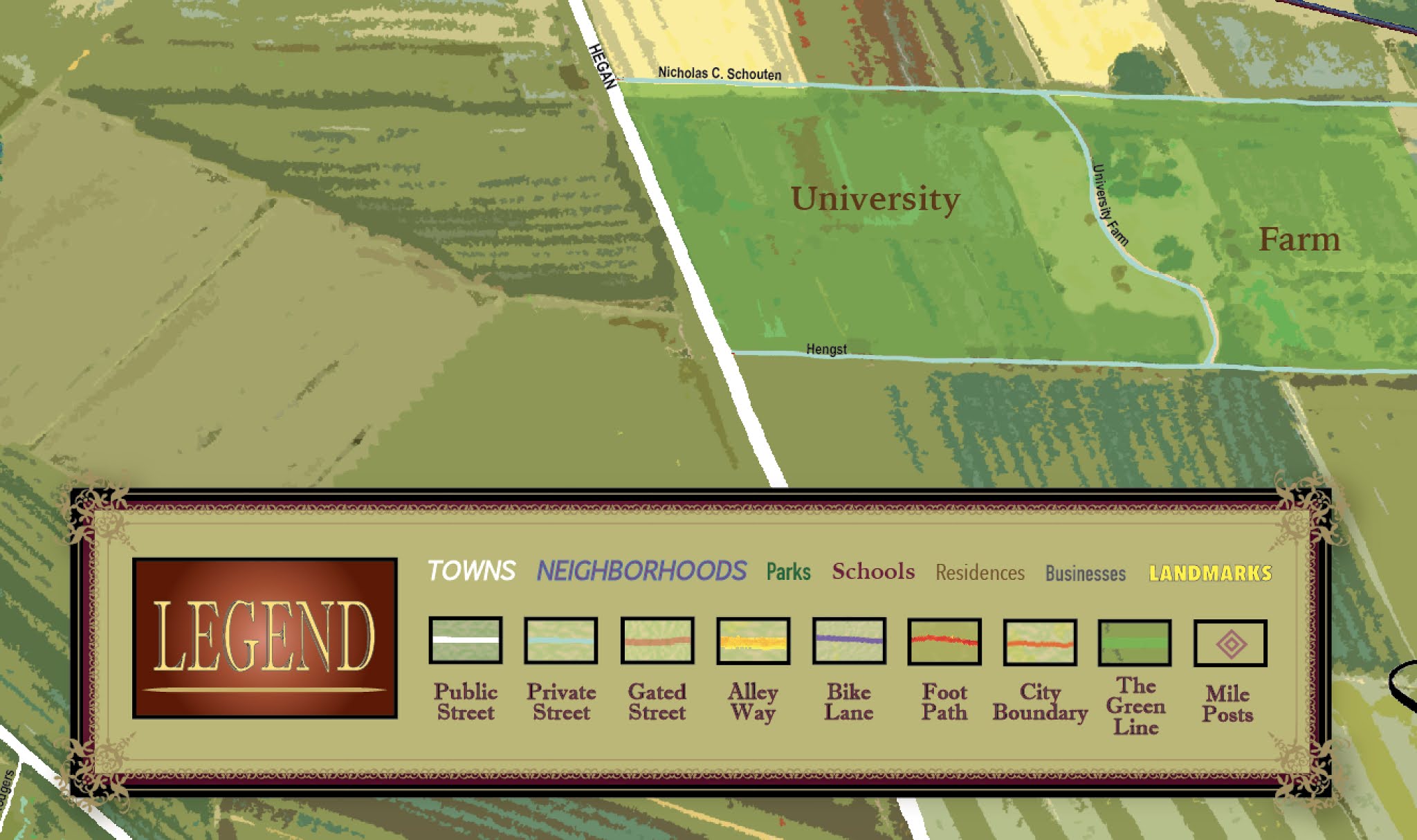
Legend box, this year including a new milepost indicator for points along a scale system

Butte Creek Canyon and the ramparts of Paradise

Chico Municipal Airport and its light-industrial neighborhood

Lake Almanor in the distance, with routes from Chico

Mount Lassen and other peaks are shown at the far horizon
This map is also available by mail order via the Mapa Jeff Online Store.
I still have a few prints and mounted wall hangings of the first edition, 2019, which takes in a bigger snapshot of the region:

If you would like a full-size print of this map, contact the artist at mapajeff@mapajeff.com.
No comments:
Post a Comment