2015-01-15

Yelapa 2015

The tenth-anniversary print is on its way. With updated business info, and colored path marks to the beach, the waterfall, and the Point, and as always, a new critter hiding somewhere. Can you find him?


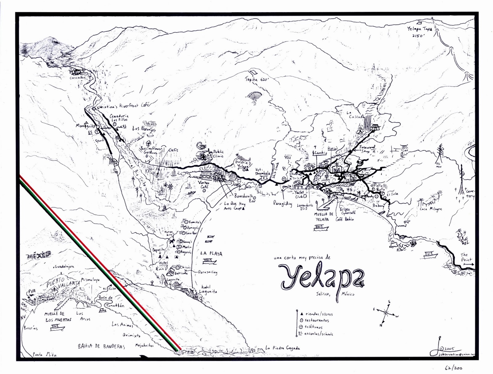
This is what the Yelapa map looked like 10 years ago:

2014-12-15

Cabo Corrientes Road Map

New for 2015

The first map of map of Cabo Corrientes designed for the traveler, this two-sided, folded map gives an easy-to-read and in-depth illustration of the region's roads, with a dozen miniature maps showing how to navigate through isolated pueblos. Size: 5 by 7 inches folded; 14 by 20 inches spread out.

Order here for mail delivery in the US and Canada.


Front:

Back:

 Details of key places:

Mini-maps of key crossroads:

2014-11-02

Puerto Vallarta Walking Map 2015

NEWLY UPDATED
The popular Walking Map now shows the old city all the way up to the "Sports Stadium" (Union Deportiva), including the cemetery and the path to Vallarta's one and only legendary waterfall.

Click here for mail order in the US and Canada.

2014-03-25

Pitillal Walking Map

New for 2014


A short bus ride from Vallarta's old town is another, even older town, Pitillal - a semi-independent municipality within greater Puerto Vallarta with some of the most picturesque urban scenery in the area. The square street grid is interrupted by arroyos (rushing rivers in high summer), verdant hills, pedestrian stairways, and whole tiny neighborhoods hidden away in the hill folds.

Like all of my maps, the Pitillal Walking Map indicates the rise and fall of the streets using an oblique side angle, facing eastward, toward the mountains where the Rio Pitillal originates in tropical obscurity.

Copies will be available at certain farmers' markets through Sandra Cesca in the 2015 season:
Individual copies may be ordered for delivery in the US and Canada via Mapa Jeff's online gallery.

2014-01-19

Puerto Vallarta en Français


POUR LES FRANCOPHONES

Avec la cooperation d'une guide touristique qui travaille avec la communauté francophone a Puerto Vallarta, j'ai recemment traduit la très populaire carte piétionnière en français. Elle montre les passerelles et les petits coins de la ville en détailles fines. Son point de vue tridimensionnel démontre aussi les montées et les chutes des rues atravers les collines. Couleur et 3D - une conception totalement nouvelle de la carte dans l'époque des images instantes terrestres sur un écran.


Vous pouvez en commander une au magazin en ligne de Mapa Jeff.

2014-01-10

2013-12-27

Riviera Nayarit Roadmap, Part II

NEW FOR 2014


Riviera Nayarit Norte highlights the spectacular north beaches up to San Blas, while revealing a bird's-eye perspective deep into the interior of Nayarit. Byways through major crossroads such as Tepic (the state capital) and Compostela are shown in thumbnail fashion, while numerous destinations on the way to Guadalajara are also visible in the distance.

Also shown are paved and unpaved roads, the new toll road from Playa Los Cocos to Tepic, mountain peaks, beaches, tourist attractions, and much more, all in Mapa Jeff's signature style and precision artistry.

The Riviera Nayarit Sur map is also complete, stretching from Platanitos all the way to Puerto Vallarta.

Order a high-quality print here